Record every step
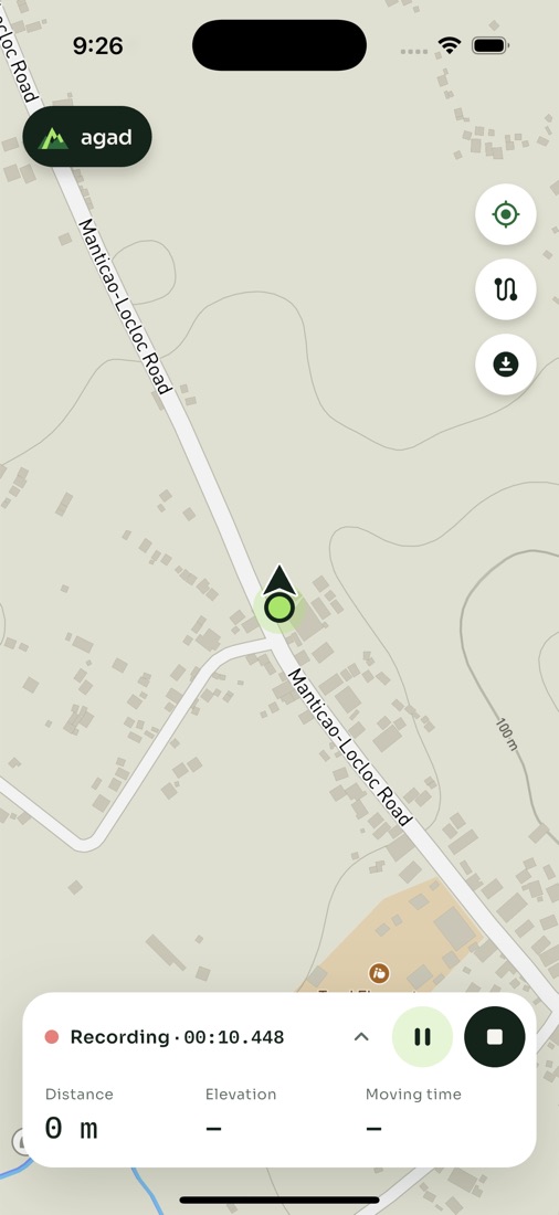
Distance, moving time, pace, climb and descent, live. Keeps going with the screen locked, and saves itself if your phone restarts.
 agad
Record your hikes and trail runs, follow GPX routes with off-trail alerts, and keep your maps on your phone for when the signal drops.
Free to use. No ads. Your trails stay on your phone.
Everything for the trail
Agad keeps recording with your phone in your pocket, guides you along a route, and works on the mountain without internet.
Distance, moving time, pace, climb and descent, live. Keeps going with the screen locked, and saves itself if your phone restarts.
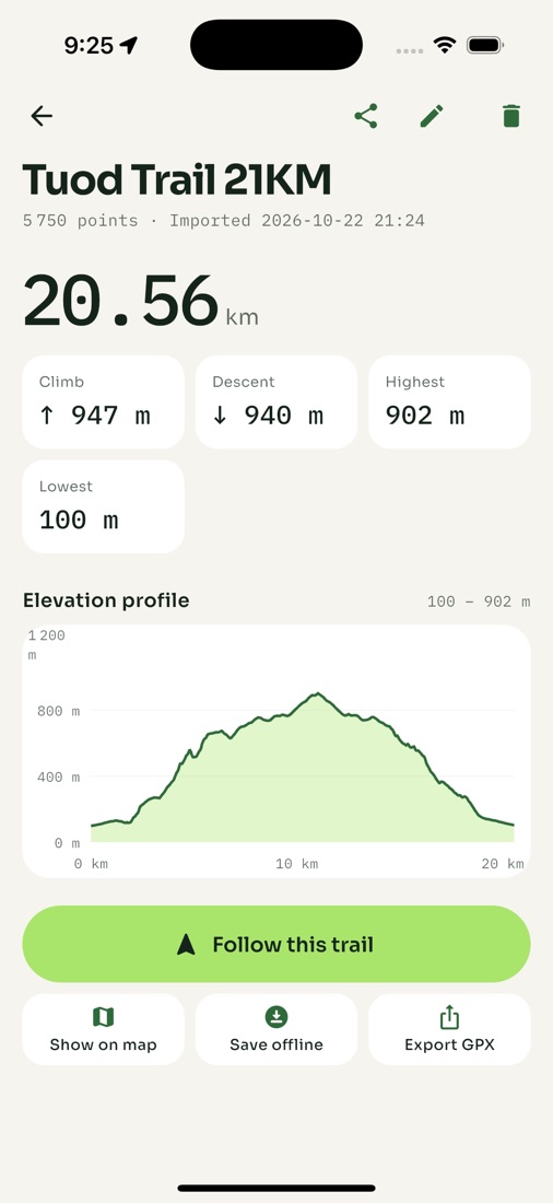
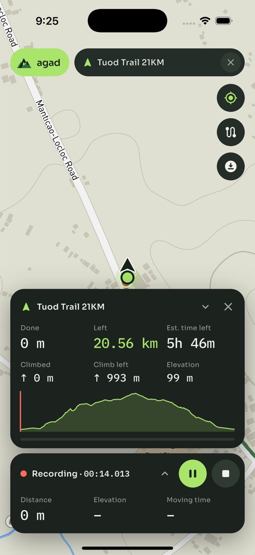
Import any GPX — Suunto, Garmin, Strava routes — and see distance and climb left, an arrival estimate, and alerts when you stray.
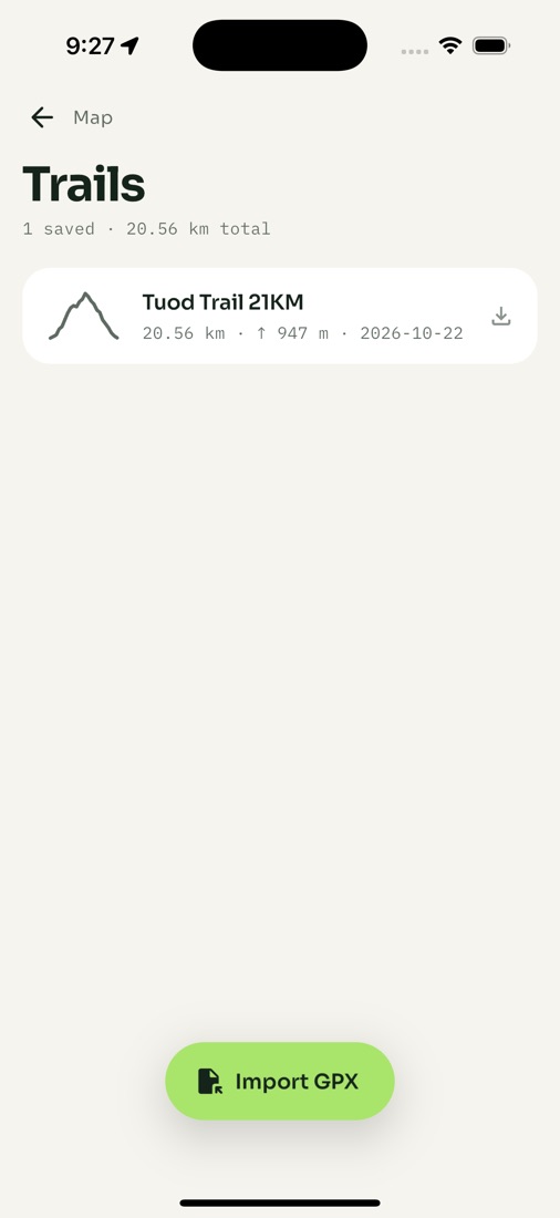
Save the area around a trail before you go. Outdoors maps with contour lines and footpaths, ready in airplane mode.
Climb is smoothed to filter out GPS jitter, so a flat walk doesn't claim a mountain. Full elevation profile for every trail.
A Live Activity on iPhone and a live notification on Android, with Pause and Finish — glance without unlocking.
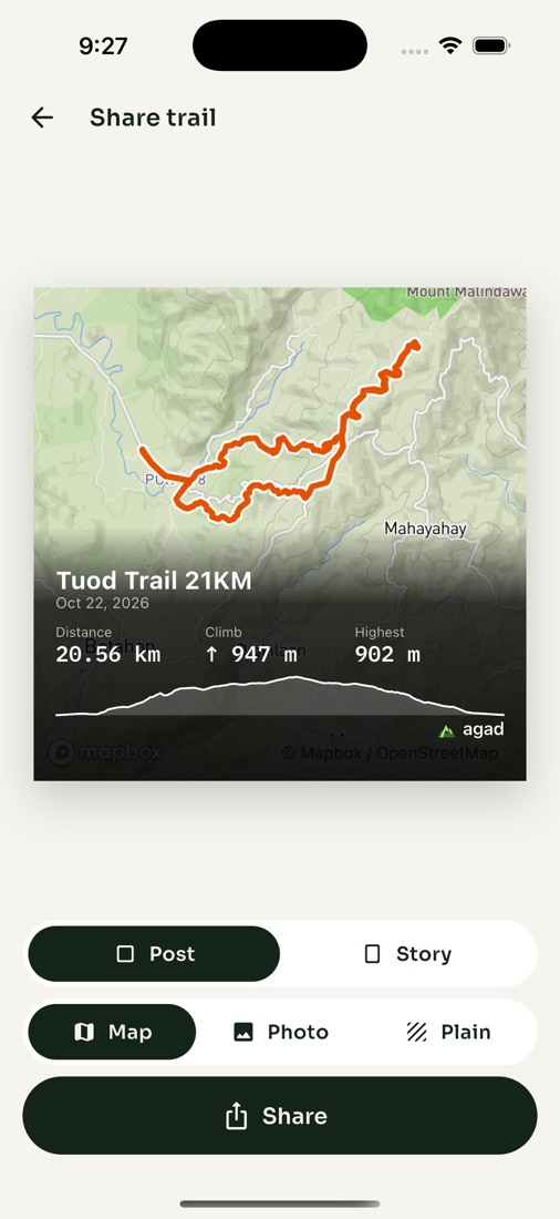
Turn a trail into a post or story image — your route on the map or your own photo, with distance, climb and time.
Follow a trail
Load the route your friends ran, or a race course, and Agad walks it with you.
Apple Watch
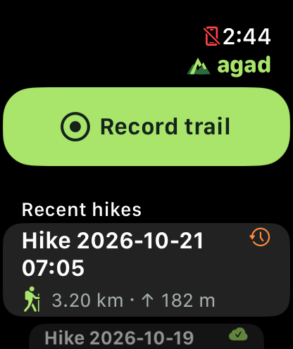
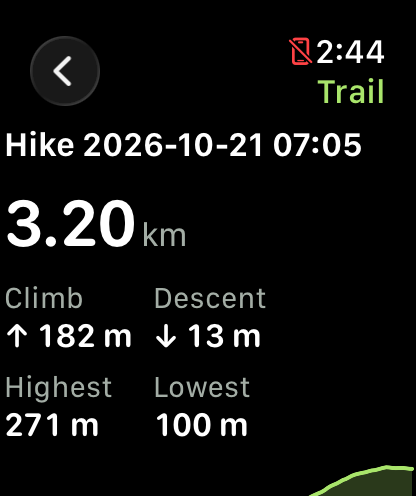
The watch app records on its own GPS and syncs your hike to the phone when you're back.
The name
The mark is its layered ridges — look at the gap between the peaks and you'll find the A.
Mount Agad-agad, Iligan · 8.18°N 124.29°E
Questions
Yes. Recording, following a trail and the elevation profile all work offline. Save a map area before you go and the map works offline too; without one you still see your track and the trail line.
Yes, on both iPhone and Android. Android phones with aggressive battery savers (Xiaomi, Oppo, Vivo, some Samsung) may need Agad set to “Unrestricted” battery use — the app asks before your first recording.
Any GPX file: tracks, routes (Suunto exports routes) or waypoints. You can export your own hikes as GPX too.
Your trails are stored on your phone. Signing in only keeps your name and email with your account. Read the privacy policy for details.
No. The watch app is optional — iPhone and Android do everything on their own.
Agad is free, with no ads.